This blog is a comparison on the friction existing in getting community interventions done in the plains versus the hills, primarily in terms of geography. I’m currently in Uttarakhand, working with INHERE, my NGO, on increasing millet productivity and its self consumption amongst the local communities. At the same time, being a native of Kerala enables me to understand the contrast that exists when it comes to accomplishing similar interventions in an easier terrain.
The first time you plan a community meeting in Uttarakhand, you plan it in the way you would for any other location. You look at the map, calculate distance, presume the planned number of people show up and that a certain distance would take a certain travel time to cover.
Then the hills correct you.
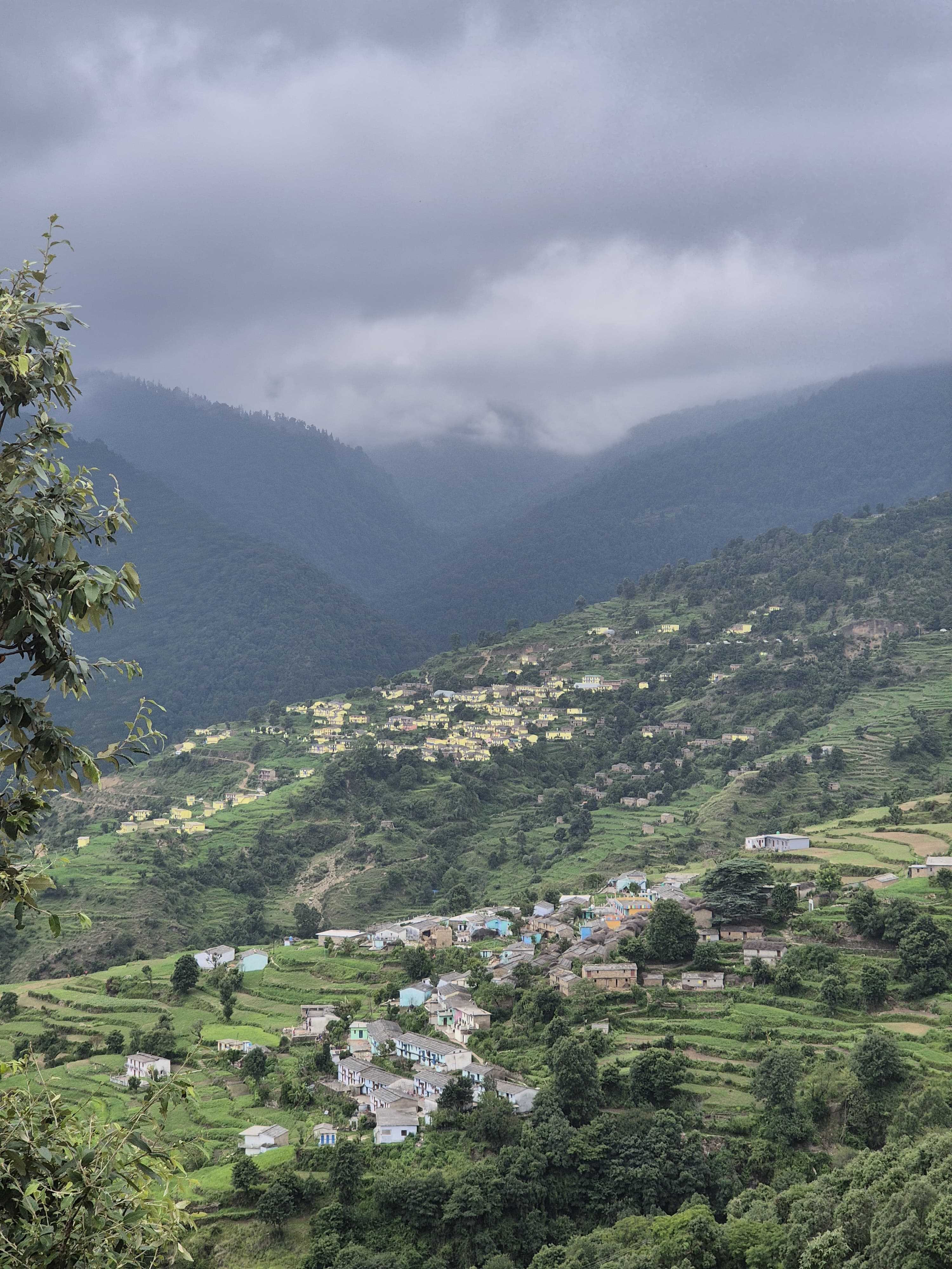
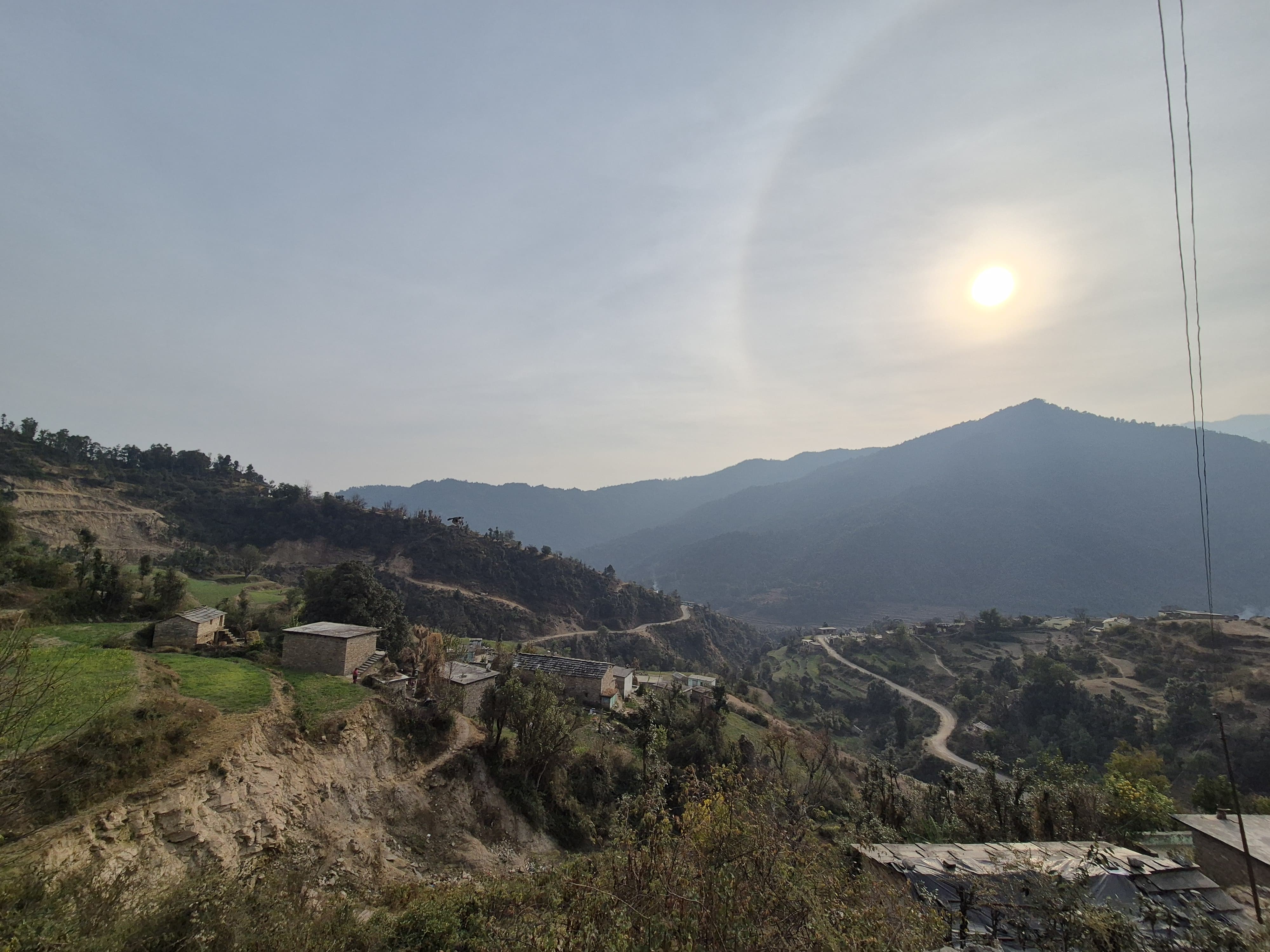
A village that appears 20 kilometers away can take four hours to reach. A road that existed last month may now be blocked by a landslide. A training planned for 20 participants becomes a gathering of 8 because the rest simply could not make it owing to ‘domestic chores’ or terrain barricades. Let me share an example of what I mean by ‘domestic chores’ ; there was a community meeting planned at 11 AM but half the women could not make it simply because they had to go to the forest in the early hours for the collection of firewood required for daily cooking and they could not traverse back through the jungle in time. This is a common instance that occurs in hilly/forest areas where terrain mixed with routine living can act as a barricade. Similarly, roads can easily be blocked by landslides or rockslides which are very common in the monsoon season. Very quickly, you realize that in Uttarakhand, terrain is not just a background but the central character that must be taken in account when conducting interventions.
Working here changes the way you think about interventions. In many parts of India, especially in states like Kerala, when engaging in community level social work the conversation begins with community mobilization, convergence, and scale of operations. In Uttarakhand, it begins with access; you have to first evaluate how feasible the access to the project location truly is. Prior to stating the time period of execution in a new proposal for a project, the project lead always puts a priority on assessing the landscape and terrain because they are the variable factors and difficult constraints involved, when it comes to the timely completion of the project. You cannot promise ‘completion of 20 community meetings in a month’ if it takes ten hours of travel in a day to go to the target location and return back to the office. Nor is it practical to live there indefinitely during the tenure of the project. Hence project timelines expand. Such a geographical constraint might not be taken into account when working in a plain area like Kerala. Terrain to be considered as a primary factor is a new insight I gained from Chinmaya (friend and project lead at INHERE).
In Kerala, you can move between villages with relative ease. Roads connect households well and public or other vehicular transport is functional. Panchayat offices or community halls can be reliably active hubs. If a meeting is scheduled at 11 a.m., it likely starts at 11:30 and there is a certain level of predictability and ease of movement. Such predictability and movement gives confidence – to communities, to field teams, and to officials. In Uttarakhand, planning feels more tentative. A one-day activity often requires two buffer days. My project involves two villages – Sarkot and Parwari – which are nearly 4 hours away from my NGO. So you can imagine how a two hour meeting could take the whole day as eight hours would go simply in travel. Hence monitoring visits are fewer, not because interest is low, but because reaching every village regularly is impractical. Within these two villages are five toks or hamlets which come under the scope of my project and traverse between toks is mostly by foot – steepy hills, narrow pathways, sharp stones, mushy gullies… the whole bunch. Thus scaling an intervention across these five villages can feel like working in five separate worlds. Even neighbouring hamlets may rarely interact due to steep terrain and limited mobility. Such factors significantly slows down the reach of impact and progress that would otherwise easily flow in villages that are situated in the plains. A recent anecdote on this was when we required a machine operation trainer to train the community members on operating the processing machinery which we had installed. We could not get him to come to the village to conduct a training session for weeks. He kept giving excuses saying he had other urgent work to attend to but we knew the truth. Reaching those villages during winter months through those snow/ice covered broken roads on his motorcycle is no easy feat and honestly, you can’t really blame him. Follow-ups require persistence and that persistence can be easily deterred by physical geography. The point here is that interventions can be greatly delayed by something as simple as terrain; thereby denying progress, benefits and impact which could have reached the beneficiaries much sooner.
Terrain and geography also heavily influence the efficiency with which government schemes can be implemented. In Uttarakhand there is no shortage of government schemes and policies that are designed to empower and help those in the lowest rung. However, in accessing them and following through lies the labour – quite literally. For instance, let’s take a simple scheme which provides agricultural loans to farming communities. In order to avail that, repeated visits to the bank are required in terms of need for submission of documentation and its subsequent verifications. Sounds obvious and pretty simple. This simple ‘visit to the bank’ however is a whole days’ work. The community member has to wake up before sunrise (as the major towns are at least a few hours away), catch whatever transportation is available – share taxi/ local buses (which are mostly infrequent) and make it to the bank within the stipulated/alloted time window. They also have to make it back home before sunset as these village roads have very poor visibility owing to lack of streetlights while being prone to dangers of wild animal attacks. Thus frequent visits to the towns, banks, government buildings are not as easy as it would be for a similar community member in the plains.
Digitalization was supposed to be the fix for the above problem by enabling folks to access various schemes through the flick of a screen. However, terrain and geography can affect interventional progress by denying digital accessibility. This is something people in the plains, myself included, take for granted. Most schemes involving online portals and Aadhaar-linked systems rely on stable connectivity and digital literacy. The terrain in these remote villages of Uttarakhand is so rugged that most telecom companies opt out from constructing mobile towers – the users are low owing to out-migration and so the profit-to-effort ratio simply isn’t appealing for them, resulting in limited connectivity in these parts.
It is easy to say the problem is awareness. Often, the community knows the scheme exists. What they lack is the time, mobility, and administrative confidence to follow up repeatedly. This is where NGOs and institutions can be of great use. They can improve digital literacy and reduce the existing gaps between the community and their accessibility to available benefits, thereby ensuring consistent and progressive empowerment.
I would conclude by saying that in Uttarakhand, every intervention negotiates with geography first, then with systems. Flexibility is not a strategic choice but is a necessity. Solutions work better only if they are adapted to address region-specific obstacles. In Kerala, the friction is lower. Infrastructure supports movement for governance systems, thereby facilitating better accessibility. In the hills, patience is a necessary virtue. The same idea that would take months to stabilize in a hill district may take only weeks to get operationalised within the plains.
Working in Uttarakhand teaches humility. The mountains resist speed and uniformity. They demand adaptation and perhaps that is the real lesson: community development is never only about funding or design. It is about context. In the hills, context is steep, rough, and unpredictable. In the plains, it is more level and connected. Understanding this difference is a key step toward designing interventions that truly belong to the places they aim to serve.
